

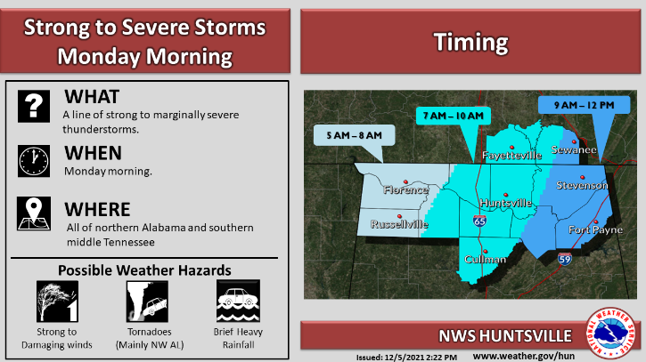
The National Weather Service (NWS) is watching a storm system that will bring showers and thunderstorms into Alabama Monday morning. Damaging winds and a brief tornado are possible.
The system is expected to impact central Alabama from 6 a.m. until noon.
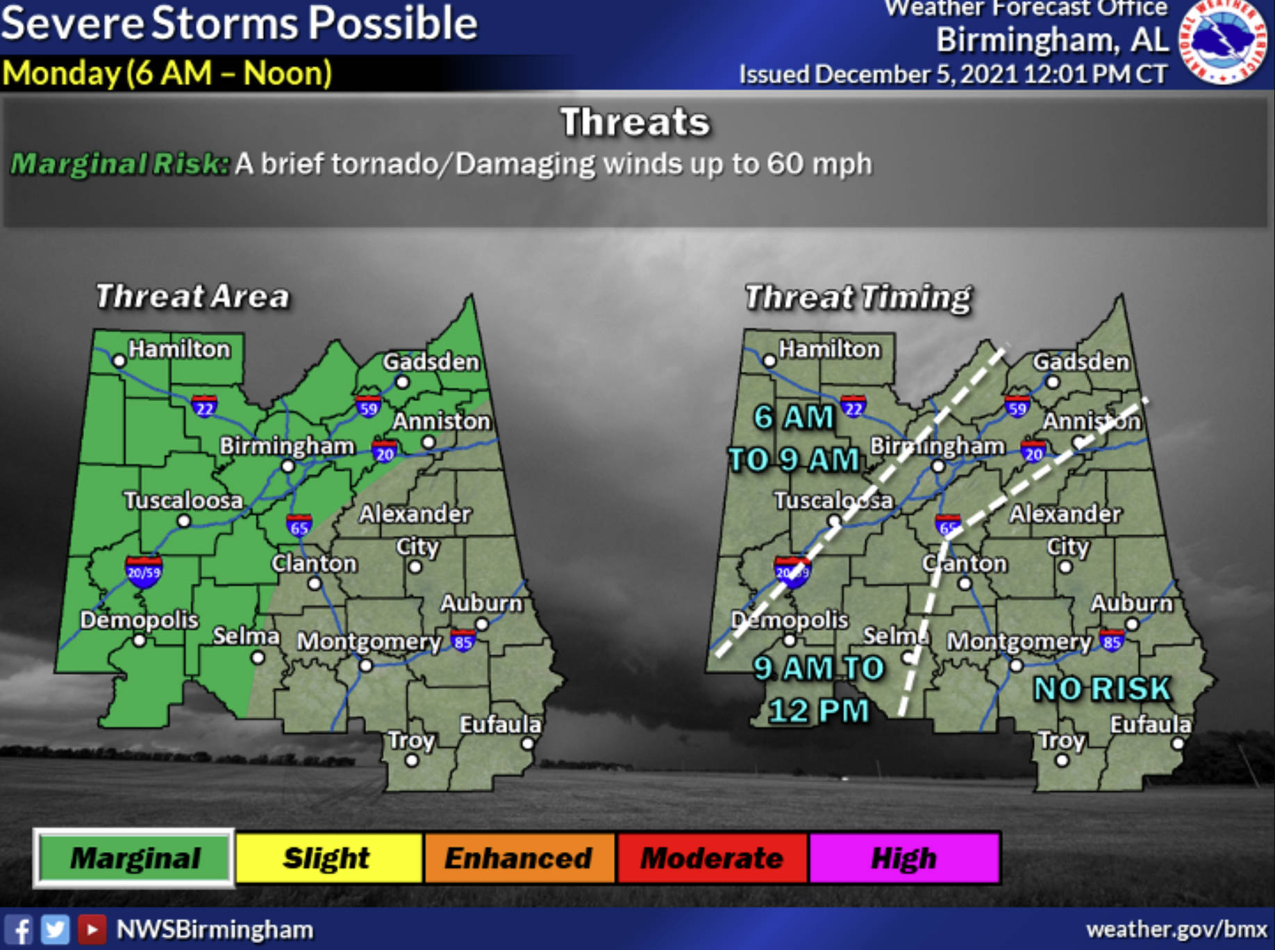
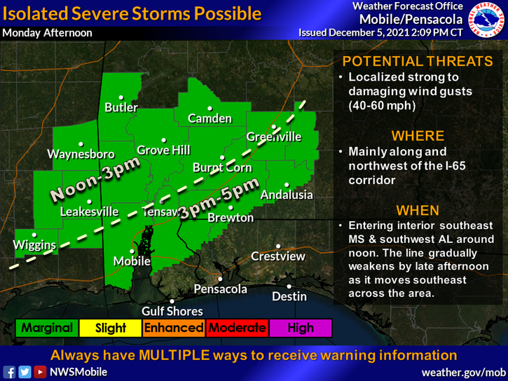
The NWS issued a Hazardous Weather Outlook for north and central Alabama, although threats remain in the southern part of the state as well.
The main threat will be damaging winds of up to 60 mph as a cold front moves in from the west.
Temperatures Sunday were into the upper 70s in some parts of Alabama and some storms formed late Sunday in the Tennessee Valley.
After the storm system moves through Monday, Alabama will likely see more rain showers throughout the week, through next Sunday, along with cooler temperatures, with possibly a light freezing overnight Monday and into Tuesday, in the northern part of the state.
Another chance for storms arrives Thursday into Friday, so stay weather-aware this week.